Welcome Aboard 2019 Gold Sponsor, Navionics.
Navionics is continuing its long-standing partnership with Summer Sailstice by supporting sailing, and donating to this year's prize pool.
Plus, Navionics is offering great deals throughout the year,
for sailors and boaters everywhere!
Take a look at June's great offer -
Navionics SonarChart™ Shading available for Platinum+ and HotMaps Platinum Charts.
An Exciting New Feature in the Satellite Overlay layer
SonarChart Shading is a new chart feature Navionics has recently introduced to their exclusive Platinum+ and HotMaps Platinum cartography products for coastal and inland fishing and boating.
Embedded within the Satellite Overlay layer, SonarChart Shading provides a detailed rendering of the seafloor and lake bottom to deliver a unique perspective of underwater topography at a glance.
Gain a Better Situational Awareness
Created from the high-definition 1’ contour data within SonarChart, varying shades of blue reveal changes in depth, drop-offs, and other features that help boaters and offer anglers clear visual cues to identify the fish-holding structures.
SonarChart Shading can be viewed on GPS chartplotters that are compatible with HotMaps Platinum and Platinum+ satellite overlay and with the same options, including selectable overlay on land, land and shallows, or full overlay. Adjustable transparency allows to view the new imagery blended with either the SonarChart bathymetry map or the nautical chart.
Don't Miss Any Details
Now available for download on HotMaps Platinum and some Platinum+ charts in U.S., SonarChart Shading is being released for other Platinum+ charts as they are ready, and can be downloaded when available. An active subscription, included with new products, is required. Check availability.
---------------------------------------------------
Navionics has donated 13 Marine Charts for this year's Summer Sailstice prize pool!
Take a look at what could be 'your prize'...
Marine Charts:
Features:
- Freshwater
*1ft contours
*23,000+ lakes and growing
- Saltwater and the Great Lakes
*1ft contours inshore and nearshore
*3’ and 6’ contours offshore beyond 90’
- Daily Updates at the rate of 2,000 per day!
Get both freshwater and saltwater charts throughout the entire US & Canada region. Navionics+ includes the Nautical Chart, SonarChart™ HD bathymetry map, Community Edits and free daily updates for one year! Simply plug your card into your PC/Mac and download the most updated charts anywhere within both US and Canada from navionics.com. Buy ‘Global Regions’ to choose one of many Navionics+ regions online. [16GB card]
---------------------------------------------------
Speaking of charts... Are your region's marine charts up to date? Navionics is constantly updating its marine charts, and you can ensure that your region’s chart’s are up to date by creating or participating in a Navionics Sonar Logging Event.
If you’re hosting a group event for Summer Sailstice (or any other club event throughout the year), register the event with Navionics and invite all the boats to participate in recording important information for your local waters.
Using your boats’ chart plotters you will log your sailing area and Navionics will then use this information to create up-to-date charts. This is a great way to ensure safe boating in your area plus, by participating in a sonar logging event you have the chance to win a Navionics+ Chart.
Take a look at these before and after shots:
Navionics will send you everything you need for the boats to record the information, and when the recordings are returned to Navionics they are turned into new marine charts for that area. Get more information here or contact Tom Branch Jr. at Navionics.
---------------------------------------------------
In addition to Charts, Navionics has excellent products to help you enjoy your time on the water -
Apps for your smart phone or device:
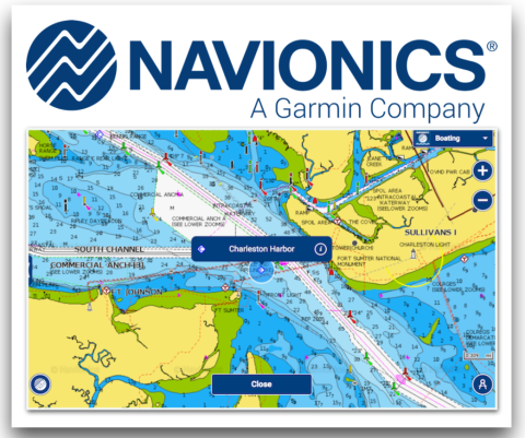
It doesn't matter what Smartphone you have, and it doesn't matter what Chart Plotter you have - Navionics has an App or a Chip to suit. Once you have the App or Chip, updates and further information are available online.
Navionics has the world’s largest database of marine and lake charts, covering the salt waters of the entire planet as well as tens of thousands of lakes and rivers. Plus they offer great support with a network of Tutorials, Webinars, Product Knowledge Articles, On-line Tips and Compatibility Guides. They also listen to thier customers, and welcome feedback on updates and any corrections you may want.
Navionics changed the way people navigate by bringing to market the world's first electronic chart device in 1984, and quickly established an early lead in marine cartography followed by a series of technological innovations, to become a global leader in quality, coverage and value. Surveys are done both in the field and with remote sensing such as satellite imagery and airborne laser scanners.
Learn more about Navionics...
"We all are avid boaters, skiers and outdoors people, we all are our own customers, we all use and test our products for our own hobbies, which means the difference between products designed by engineers for the use by engineers, and products made by users for the benefit of everyday people."
So if you haven't yet, Sign Up for Summer Sailstice to be in the draw for one of these great products. Or why wait until June? Get online with Navionics now, take a look at the wide range of options and down load the Free Trial - you'll never need to get lost again!